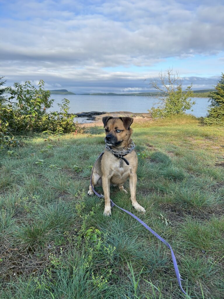
Bella and I woke up on the beautiful shores of Lake Superior and went for a walk around the campground. I took a much needed shower, then we were off!
I saw some cool geology along the way, including sedimentary iron rich rocks overlain by volcanic rock (not shown). Later I gathered it’s about a billion years old, give or take…
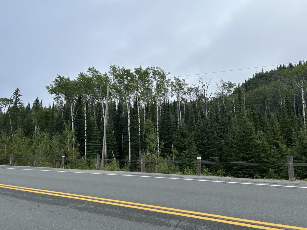
Here we see boreal forest ecosystem succession at work. Not the spruce trees growing up underneath the birch… “we’ll take it from here,” they say. Amazing the whole story is right here in one picture!
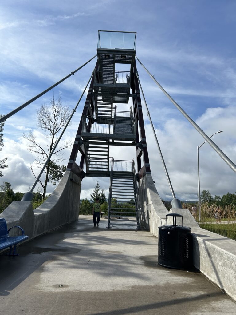
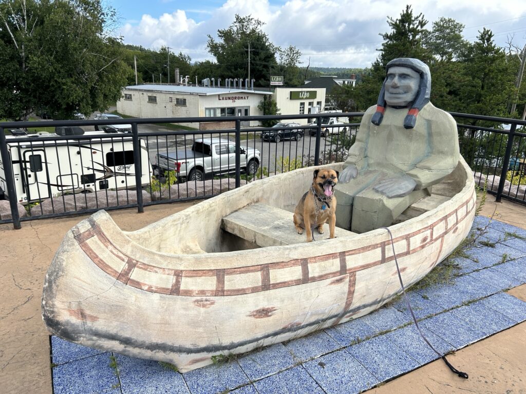
We made it to Nipigon, with an amazing geological and cultural history. Here’s a cantilevered tower where one can see the bay. The stairs are made of metal grate… Bella did well on the way up but I ended up carrying her down.
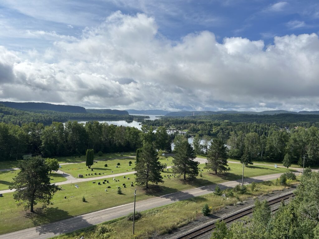
At the top we saw this beautiful view!
I most wanted to see the Paddle to the Sea exhibit. And here it is! See here for the first part of the book. Also look it up on Wikipedia. A true Great Lakes tale, which I loved in my childhood and now as well. These days it’s also a snapshot on time of 20th century Iron Belt industry.
We also stopped in at the local museum, where an old timer wanted to tell me all about everything. Fur, then lumber were the big industries in Nipigon (read paddle to the sea), and running logs down the Nipigon river was apparently quite a challenge! the river was dammed in the 1920s, which kind of put an end to the rapids and such. Nipigon also has huge trout, although as elsewhere, human changes (including the dam) aren’t helping them.
I also learned about the artist Norval Morrisseau, an indigenous artist who fought for along with other artists in the region to have indigenous artists taken seriously alongside other Canadian artists. He developed his own abstract style featuring animals and people with x-ray insides. See here for samples of his work, and look him up on Wikipedia of course. Pretty cool!
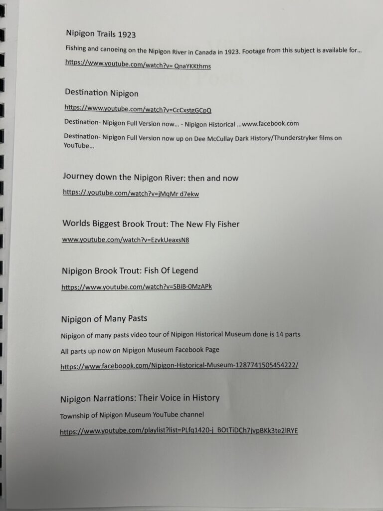
The man in the museum gave me a number of videos to watch, including I believe the paddle to the sea movie. I have not had a chance to watch any of them (yet), but you can do so now. Here the are:
The museum also has printouts of online conversations regarding Vikings, and whether they came to Nipigon or not. Something for serious scholars, but I didn’t have time to go down that rabbit hole.
Anyway I had a great time in Nipigon but then time to hit the road again. I avoided time traps such as huge canyons emptying into Lake Superior, upriver waterfalls and an amethyst mine (amethyst is the provincial gem and is mined here). Must keep moving toward Alaska…
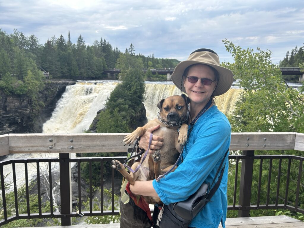
We made it to Thunder Bay, a dreary but useful town where I stocked up on gas and food. About a half hour west of town I stopped at Kakabeka Provincial park where I saw one of the many spectacular waterfalls and canyons in the region. I also saw a billion year stromatalite fossil. super cool!
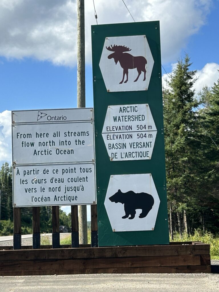
Then back on the road. This is a “portage” region where people would portage their canoes between the Hudson Bay and Great Lakes watersheds in the time of the fur trade. Eventually a railroad and later a road was built. So no more portages. Here is where I passed between those two watersheds. Kind of a shock to hear the word “Arctic,” reminds me I’m on my way to Alaska. But to be fair, Fairbanks is in thr Yukon River watershed, which empties into the Pacific Ocean near none. So somewhere I will hit another continental divide, moving from arctic to pacific. Stay in the lookout…
Shortly after, I crossed into central time. This area was significant as boundaries between the Hudson Bay land, Great Lakes indigenous nations, and also Ontario vs Manitoba.
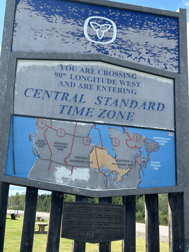
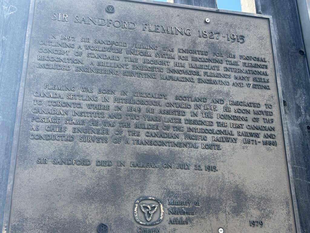
But I did not know until today that we can thank a Canadian for time zones. Before they, every city was on a different time, and that made it really difficult for railroads. See here for the chaos that ensued before a Canadian saved the day and set things straight in France.
And then we kept driving… at the end of the day Bella and I had a beautiful picnic. In this photo one can also see how scraggly the spruce trees are, like the trees growing on top of permafrost in Fairbanks. This area is relatively flatter than a couple hours east. There are large low lying areas of scraggly trees, and every time there’s a little hill, the trees are more robust. I believe the low lying areas are growing just a few cm above the (igneous) Canadian Shield, hence a similar situation as growing in top of permafrost. Anywhere there’s a hill of till, that creates better conditions. All the forest here is managed, as evidence by the numerous logging access roads. I’m not sure what they can make with scraggly spruce trees, probably paper.

Anyway that’s all for today! Tomorrow I expect to hit the prairies. Corn field meet wheat field… good night!